Paris is a fantastic city, and if you want to move efficiently in the city, the metro is the best way to do it. There are more than 300 metro stations in Paris, and you can reach all those stations with more than 15 different metro lines. All in all, Paris has one of the busiest metro systems in the world and maybe the most used metro system in Europe.
The first metro line in Paris opened in the year 1900. It has grown rapidly, and there are more than 225km of metro lines in Paris today.
It can be hard to find what you are looking for at first, but once you know the metro system, it is very easy to use and efficient.
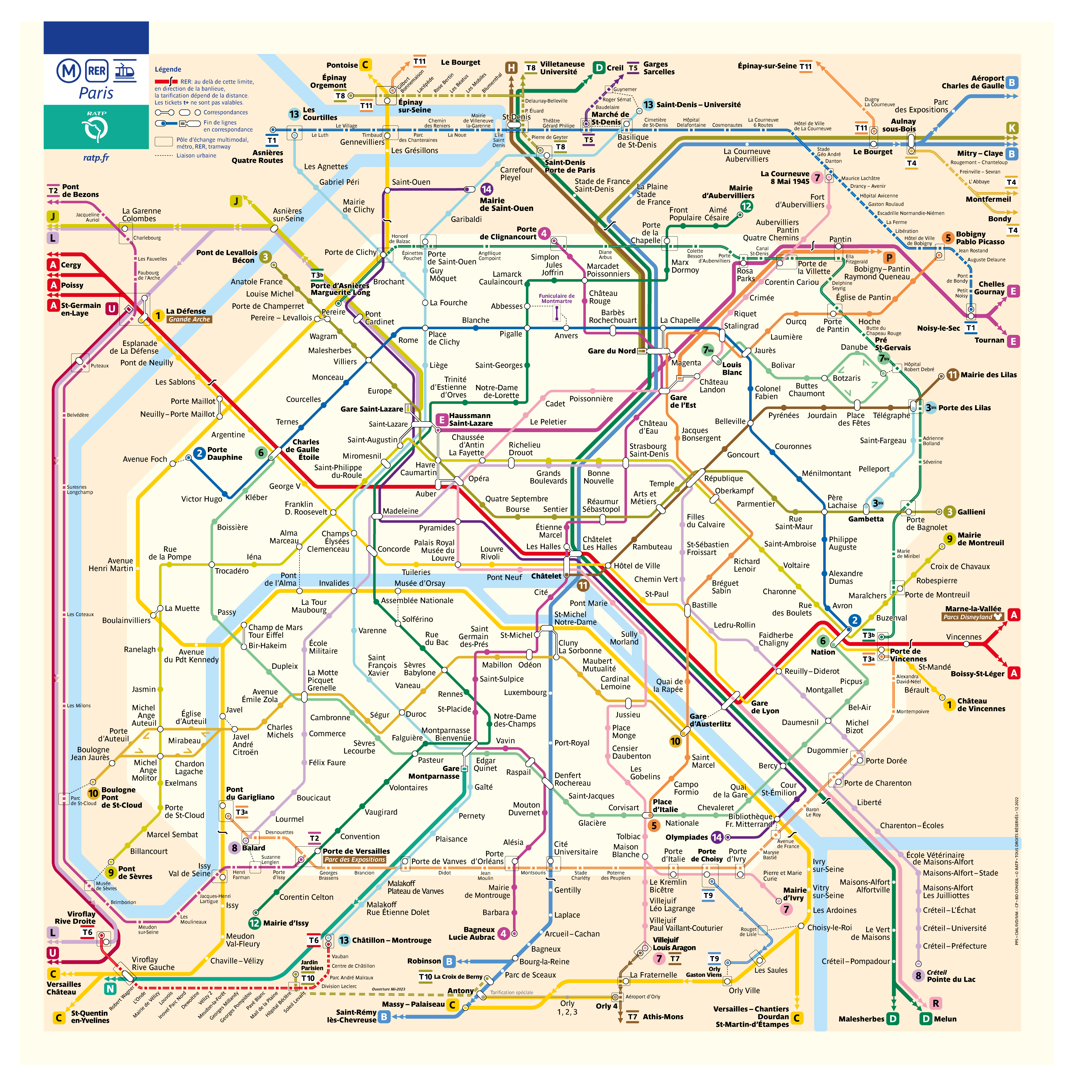
Paris metro map
Here you can find a new and updated map showing the metro system in Paris. Click the map to see it in higher resolution.
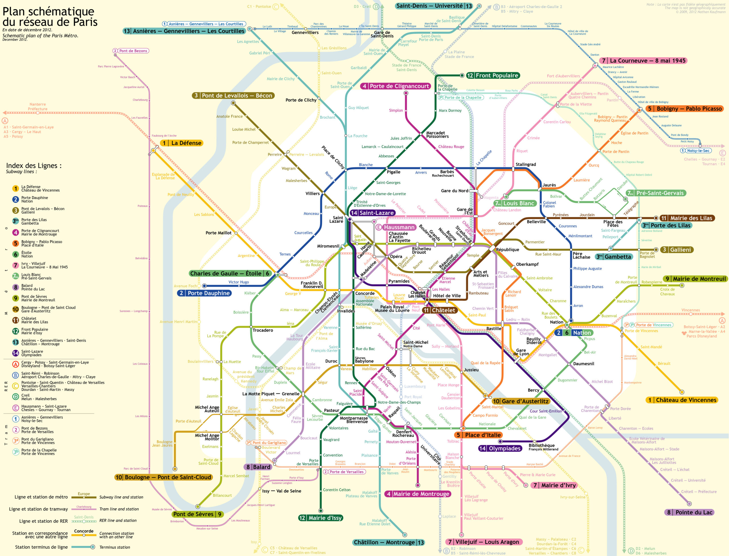
Here you can also look at a different version of the same metro map. Click the map to see a larger version.
Which metro should I use in Paris?
- Would you like to attend the popular Rock de Seine festival in Paris? Travel by metro to Boulogne – Pnt de Saint-Cloud (end station of metro line ten).
- Going to the Eiffel Tower? Travel with metro line 6 to Bir Hakeim and walk from there.
- Are you attending a concert in Bercy? Travel by metro line 6 or 14 to the stop Bercy.
- Would you like to see the beautiful Notre Dame? Travel by metro line 4 to the stop Cite.
- Do you need to catch a train from Gare de Nord? Travel with metro line 4 or 5 to Gare de Nord.
A traditional Paris map.
Would you like to have a look at a traditional Paris map? Below you can see a Paris map with the locations of many of the most popular attractions in Paris. Click the map to see a high-resolution version of the map where you can zoom and see even more details.


